Automatically importing Raster Maps

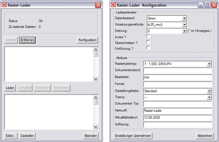
Raster data can be imported and georeferenced automatically in Smallworld GIS using the ITS Raster Loader. The processing method supports all types of layout formats. Furthermore, the Raster Loader adopts attribute settings that can be used for further editing in raster maps.

  • Importing mass raster data into Smallworld GIS
  • Raster maps are automatically georeferenced
  • Different layout formats are supported
  • Easy configuration of processing methods
  • Further editing functions for raster maps

Product Description

Importing ASCII Files

ITS Raster Loader offers an efficient alternative to traditional raster map imports, i.e. the raster map editor in Smallworld GIS. It was developed with the main goal of importing and georeferencing large sets of raster map data in a short period of time. Each raster map is georeferenced by the ITS Raster Loader via the file name or through an additional file containing corner coordinates of the map.

Implementation Method

The implementation method is created using a documented programming interface. Data that is trimmed in advance requires no post-editing. The implementation method required for import is selected in a configuration menu within the ITS Raster Loader. Additional specified attributes and parameters are applied for all raster maps that are loaded into the ITS Raster Loader tool.

Post-editing Raster Maps

If the option “Post-editing” is activated in the configuration menu, the programme will check whether a map with an identical name already exists in the system. If this is the case, the original raster map is replaced with the new one. The object “FS Raster Map” as well as its geometries remain intact. Thus, the Raster Loader is an ideal tool to efficiently update all raster maps in regular intervals.