Generalisation of Overview Maps
With the product ITS GeNSI®, a generalised overview map can be created based on an existing and more detailed map. The workload is significantly reduced by automating the generalisation process compared to manual editing. Several overview maps can be generated for sector-specific data models using ITS Multi-Plan.
- Generalising networks, structures and information
- Overview maps are generated automatically based on existing detailed maps
- Optimised documentation process and reduced workload
- Parallel generation of overview maps (e.g., 1:5000, 1:10 000)
- Generalisation configuration by the user
Product Description
ITS GeNSI®
The Product ITS GeNSI® was developed to easily create overview maps derived from detailed maps. This means that the generalisation process is based on geometry objects in detailed maps. These geometries are used to create overview maps. ITS GeNSI® can be used to create an overview map for the first time or to edit an existing one. Furthermore, ITS GeNSI® is compatible for any sector and includes the following modules:
- Line smoothening
- Intersection corrections
- Text editing
The aim of ITS GeNSI® is to reduce manual editing work in overview maps with pipeline or power line networks. Configurations for individual modules are modified in a special menu. This menu is also used to launch modules. Furthermore, all processing steps are triggered and executed in this menu. Feature classes and database objects that should be excluded in the generalisation process are marked with a flag symbol.
Line Smoothening
The ITS GeNSI® line smoothening module generalises knots, lines and curves of line objects. In the proces, two central mechanisms are used:
- Line smoothening (Douglas-Peuker-Algorithm)
- Knot reduction
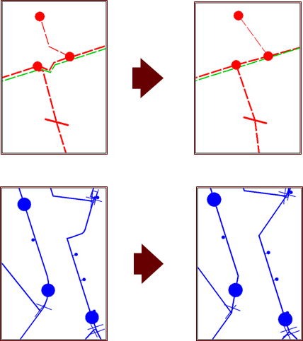
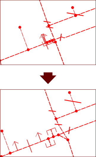
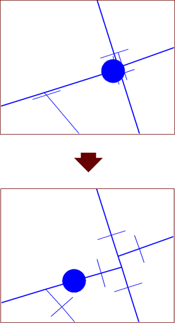
Intersection Corrections
When geometries of a detailed map are copied into an overview map, the overview map has a very high geometry concentation. This is especially visible at intersections. As a result, intersections in overview maps have to be generalised to improve legibility. This means that the precise location of assets is not the main focus when interpreting overview maps, but rather the relation and proximity to other objects. However, the order/sequence of assets has to be indentical to the order/sequence in the original detailed map.
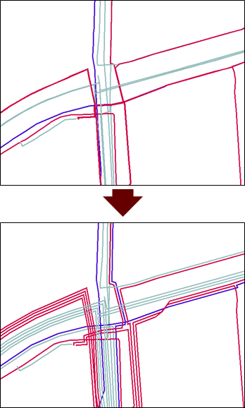
Power Grid Generalisation
A power grid includes unique requirements for automatically generalising overview maps. The so-called jostle method was specifically developed for this solution and takes these special requirements into account.
One special problem arises when shifting geometries in a power grid. For example, if parallel power lines require a minimum distance of 2 meters, a route with numerous power lines can quickly exceed a width of 10-20 meters. Therefore, geometry displacements are uniquely computed using the jostling method.